Hello experts, could you recomment some effective tools for radio network coverage planing for LoRa/LoRaWAN (supporting Google maps) which are used in practice.
Best regards Vycheslav Khudyakov
Hello experts, could you recomment some effective tools for radio network coverage planing for LoRa/LoRaWAN (supporting Google maps) which are used in practice.
Best regards Vycheslav Khudyakov
Hi, you might try this one. It is the only one I know of
http://www.atdi.com/lora-network-planning-and-sizing/
hi .
besides al the highly expensive profi tools availible there is a cheap and free alternative.
“radio mobile”
http://radiomobileonline.pe1mew.nl/
the frequency 868 of 915 for lora is possible not present … but choose te 900mhz amateur band will give a similair result …
i have tried it and it comes close to real world …
you have put in all details of your gateway and it wil plot you a nice map.
there is also a online version at http://www.ve2dbe.com/rmonline.html
/Joost .

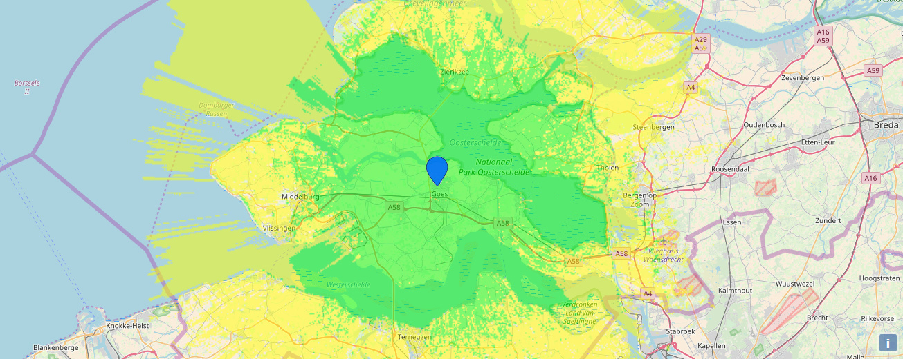
made with the use of the online tool
Check out https://cloudrf.com/
Creates KMZ files for Google Earth, good mix of features, tiered pricing plans that are very cheap if you only use the service occasionally.
Hi,
How to model the gateway and device accurately ?
Have you compared the results of http://www.ve2dbe.com/rmonline.html with any commercially available network planning tool ?
Thanks for the help.
Best
Kamran
eHi kamran.
de differents between de commercial and freeware is not much … it all depends on the terrain data accuracy. some is better than others … the differents between the frequencies is not much.
The used bandwith is also a factor. a wider signal needs more signal lever or energy to decode.
however the tool wil give you a very good start with planning your gateway and sometings it explanes why a gateway coverage is so bad compared to others … on 900mhz freq such things as trees become a problem somer and winter can be different .
and the type of used gateway antennas are key in this …
example : you take a simpel antenn on a 100+ meter high tower or building the radiation diagram is absolute important …it should “beam” to the horizon and not upwards like many of the antennas used .
grt Joost .
Hi,
I have been using both commercial rf propagation tooling and Radio Mobile for the last 20 years and have found that radio Mobile can be very accurate as long as the parameters are set properly.
I even used radio Mobile for some consultancy jobs in situations where I did not have commercial tools or terrain data available. I thise case I verified predictions with drive test data and they mtach fine.
If you need help on radio mobile or radio mobile online you are happily invited to visit my website on radio mobile: http://radiomobile.pe1mew.nl/
I totally agree with you. In the past I used Radio Mobile in a proof of concept for an 802.16 network in the 3.5Ghz band and the results thrown by Radio Mobile were very similar to those of commercial tools.

Check out this tool, under other features it has a powerful instrument for LoRa radio planning: ONEPLAN RPLS-XML – InfoTel
I think you can even ask for a demo version here: