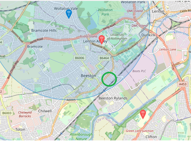
Just to update the community today we have decommissioned the Lenton Abbey GW due to premises access issues and a need to update the system.
It will remain offline (other than for configuration/update testing down in the Thames Valley base office so please ignore location if you see it reappear!) until sometime hopefully early/mid September at which time it will be recommissioned and installed in the S.East Beeston area around the A6500 Queens Road and the railway line per the graphic attached to this post. We then expect the GW to remain in place for between ~1 & 3 years. Hopefully the new location shoud improve coverage as current location is partly geo masked by the Uni hill to east, the rising ground towards the north and the A52 and the rising ground to the east of Beeston. The new location should allow overlapping coverage between the Nottingham Trent Clifton GW and the GW over the hill in Wollaton Vale. Will publish mapping/coverage info Sept/Oct once measured and ealuated but expect some coverage from the Attenborough Reserve to around Dunkirk and up the Woodside Road area around B6006 and B6464 and Clifton escarpments/rising ground towards the A453.
